for ACADEMIA AND RESEARCH:
-check SERIAL AND COLLECTIVE (Master Students and Option Studio)
-check CORE DIGITAL ARCHIVE (Core Studio II)
(outside academia)
for ACADEMIA AND RESEARCH:
-check SERIAL AND COLLECTIVE (Master Students and Option Studio)
-check CORE DIGITAL ARCHIVE (Core Studio II)
ONGOING AND COMPLETED PROJECTS
Negentropic Fields. Co-curated exhibition at National Gallery Singapore, 2020. Development and design of immersive-interactive. Environments.
“Trace 2”, collaboration with Teow Yue Han, a project for Singapore Art Museum, part of “Can Everybody See My Screen?”, 2022.
”Unity and Multiplicity”, 4min animation included in Ho Rui An’s work “The Economy Enters the People”, 2022.
“Common Landscapes”, data visualisation and real-time rendering for the interactive feedback form commissioned by YLab-NGS, 2021.
Shenzhen Bi-city Biennale, 2020. Development of VR and AR components + physical installation (200 sqm).
Lisbon 2019 Triennale. Showcase of formAxioms work, development and showcase of AR and VR interactive experiences.
On going__HotHouse curatorial work.
On going__Centre for the Future – (SUTD with Pratt Institute NY).
On going__Collaborative Platform for design and visualisation, Singapore University of Technology and Design.
On going__Digital Gallery Extension (confidential).

Here’s what our research cluster provides:
We test new modes of visualizing complex systems (with multi-layered data) within immersive environment (either VR or AR) in order to facilitate discussion/confrontations between team members and or with external users. Immersive and interactive visualizations of complex territorial strategies are deployed with interactive apps. Apps are designed with two aims in mind: to create virtual roundtables where professional can meet discuss and annotate in space ideas and comments, to form platforms where communities can discuss the spatial implications of decisions and to give them a virtual space where participatory practices can emerge.

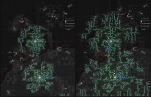
We design digital models to analyze and discuss what constitutes the territory’s complexities. We create indexical cartographies of selected areas in order to understand hidden and unforeseeable environmental (anthropic or geological) hazards, for preparing alternative, ecologically sustainable responses to them. Computationally based cognitively reconstructed models serve the purpose of visualizing the network of ecological niches that are currently or potentially threatened by active (or about to emerge as active) anthropic factors. Design and Computation: all stages of our research are thoroughly enmeshed within computational logics, as it is the discovery/invention of hidden parameters, being them digital or material in nature, that allows the designer to recreate “new natures”; infra-structural and aesthetic.

Models are made to understand the possibilities of enhancing local productive systems without falling pray to naive localism but to empower the transformation/emancipation of existing communities – and possibly to form new ones. Strategies and tactics are designed to creatively propose new forms of infrastructure for highly complex and environmentally hazardous areas, to design the built environment avoiding mono-cultural segmentation of the territory —the fragmentation of landscapes by infrastructural cuts and/or by spaces of inhabitation that have no geo-morphological relation to the land that host them.
